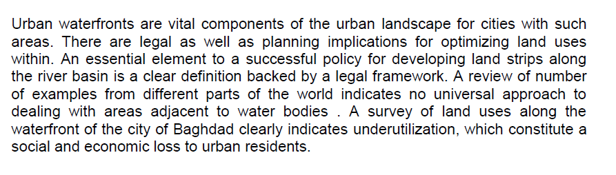
Analytical Perspective of Baghdad Urban Water Front Land Use Utilization
Analytical Perspective of Baghdad
A land magnetic survey was carried out along regional profile, which is located at the north part of the Iraqi western desert. It starts from al –Qaam City (at north) toward Rutba City (at south) with a total length of 238km. The survey was carried out along the paved road between the two cities, About 113 measuring points were done with inter-station distance of 2 km (for 198 km) and 2 to 5km (for 40km). Two proton magnetometers were used in this survey. One of them is used for base station monitoring, which was fixed as of Salah Aldin field (Akkas). Its readings were used for diurnal corrections. All magnetic measurements were corrected for normal and topographic corrections. The readings were reduced to a certain base level. The resu
... Show MoreSeptember 11th attacks held the biggest tragedy in American history. It was a day of grief, and it proved that America was not immune to attacks and threat. Afterwards life has changed not only for the American Muslims but also American Christians and Jews and to people from other religions. The cruelty of that day has left its shed particularly on the Muslims’ life in America who in reality had nothing to do with the attacks. Arab American Muslim writer Laila Halaby’s novel, Once in a Promised Land, intensely displays the problems that Arab Muslims went through after September 11th attacks. This paper discusses this issue through analysing Halaby’s novel, where she deals with the issues such as discrimination, stereotype, and prejudi
... Show MoreThis research depends on the relationship between the reflected spectrum, the nature of each target, area and the percentage of its presence with other targets in the unity of the target area. The changes occur in Land cover have been detected for different years using satellite images based on the Modified Spectral Angle Mapper (MSAM) processing, where Landsat satellite images are utilized using two software programming (MATLAB 7.11 and ERDAS imagine 2014). The proposed supervised classification method (MSAM) using a MATLAB program with supervised classification method (Maximum likelihood Classifier) by ERDAS imagine have been used to get farthest precise results and detect environmental changes for periods. Despite using two classificatio
... Show MoreSea level rise (SLR) due to climate change is affecting the coastline, causing shoreline changes, the degradation of mangrove forests, and the destruction of coastal resources. This is the cause of a huge amount of mangrove degradation in many parts of the Ganges–Brahmaputra–Meghna delta. A total of 90% of people have been forced to migrate from the island due to extreme weather conditions. In this study, remote sensing (RS) and geographic information system (GIS) techniques were used for LULC change and shoreline shift analyses of Ghoramara Island. LULC classification was carried out using thirty years of Landsat datasets with intervals of ten years (1990 and 2000) and intervals of five years (2005, 2010, 2015, and 2020). The classific
... Show MoreThe role of filamentous bacteria represented by Streptomycessp was studied as biological treatment for activated sludge AL- Restomia treatment unit in Baghdad city. The result shows reducing in phosphate concentration where apprise in started entrance the treatment unit 12.083 mg/L fast the unit stages reached to 8.426 mg /L where nitrate concentration apprises 3.59 mg/l and ending in 2.43 mg/L The concentration of ammonia apprises 1358 mg/L and reached to 140 mg/L. also the TDS concentration reduced from 1426 to 1203 mg/L where nutrient which represented (SO4, Mg, Ca, Na, K) reduced by range 30.883- 23.337 , 194- 121 , 440- 321 , 109.03- 101.53 and 16.85- 15.4mg/L respectively COD reduce from427.263- 82mg/L with absorbance0.018- 0.027
... Show MoreSince its invention by the Ancient Romans and later developed during the mid-18th century, the concrete structure and finish, has been considered as the most powerful, practical, economic and constructional material that meets the building’s architectural and aesthetical requirements. By creating unique architectural forms, the pioneer architects used concrete widely to shape up their innovative designs and buildings.
The pre-mixed ultra-high performance concrete which manufactured by Lafarge.
The transparent concrete and cement that allow the light beams to pass through them, introduces remarkable well-lit architectural spaces within the same structural criteria. This product is a recyclable, sustainab
... Show MoreAO Dr. Ali Jihad, Journal of Physical Education, 2021
Urbanization led to significant changes in the properties of the land surface. That appends additional heat loads at the city, which threaten comfort and health of people. There is unclear understanding represent of the relationship between climate indicators and the features of the early virtual urban design. The research focused on simulation capability, and the affect in urban microclimate. It is assumed that the adoption of certain scenarios and strategies to mitigate the intensity of the UHI leads to the improvement of the local climate and reduce the impact of global warming. The aim is to show on the UHI methods simulation and the programs that supporting simulation and mitigate the effect UHI. UHI reviewed has been conducted the for
... Show MoreThe approach of greening existing buildings, is an urgent necessity, because the greening operation provides the speed and optimal efficiency in the environmental performance, as well as keeping up with the global green architecture revolution. Therefore, greening existing buildings in Iraq is important for trends towards renewable energies, because of what the country went through economic conditions and crises and wars which kept the country away from what took place globally in this issue. The research problem is: insufficient knowledge about the importance and the mechanism of the greening of existing buildings, including its environmental and economic dimensions, by rationalization of energy consumption and preservi
... Show More