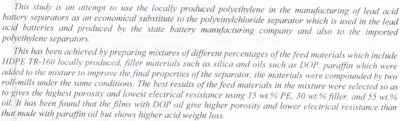
The Manufacture of Lead Acid Battery Separators using Locally Produced Polyethylene



Hydrocarbon production might cause changes in dynamic reservoir properties. Thus the consideration of the mechanical stability of a formation under different conditions of drilling or production is a very important issue, and basic mechanical properties of the formation should be determined. There is considerable evidence, gathered from laboratory measurements in the field of Rock Mechanics, showing a good correlation between intrinsic rock strength and the dynamic elastic constant determined from sonic-velocity and density measurements. The values of the mechanical properties determined from log data, such as the dynamic elastic constants derived from the measurement of the elastic wave velocities in the material, should be more accurate t
... Show More (1)
(1)
 (1)
(1)
Baqubah city has grown extremely rapidly. The rate of growth exceeds the growth of services that must grow side by side with the growth of population. There are natural features that affect the growth of Baqubah city such as Dieyala river, Alssariya river, in addition to agricultural areas .All these natural features affect the growth of Baqubah city in the running form being seen . In this research the remote sensing and geographic information system (GIS) techniques are used for monitoring urban expansion and forecasting the probable axes to the growth of the city, and found that the probability of Baqubah growth to east is preferred due to Baqubah growth to the east would never interfere with natural features. Also in this res
... Show More
The current study aimed to standardize the multi-position suicidal tendency scale MAST in the Saudi environment as well as to assess suicidal tendencies in adolescents. Moreover, the study aimed to test the psychometric characteristics of the scale among a sample of (490) high school and undergraduate students, in the adolescence who ranging in age from (16-21) years. The scale demonstrated satisfactory internal consistency in terms of validity and reliability tests. as the results showed of exploratory factor analysis to the four dimensions of suicidal tendencies loading on two factors that accommodate 74.60% of the overall variance of the scale (1) the attitude toward life, and absorbs 43, 20% of the total variance of the scale,
... Show MoreAbstract
The project of balad's major sewerage system is one of the biggest projects who is still in progress in salahulddin province provincial - development plan that was approved in 2013 . This project works in two parts ; the 1st is installing the sewerage networks (both of heavy sewerage & rain sewerage) and the 2nd is installing the life – off units (for heavy sewerage & rain sewerage , as well) . the directorate of salahuiddin is aiming that at end of construction it will be able to provide services for four residential quarters , one of the main challenges that project's management experience is how to achieve thes
... Show More
A theoretical study to design a conformal microstrip antennas was introduced in this work. Conformal microstrip antennas define antennas which can be conformed to a certain shape or to any curved surface. It is used in high-speed trains, aircraft, defense and navigation systems, landing gear and various communications systems, as well as in body wearable. Conformal antennas have some advantages such as a wider-angle coverage compared to flat antennas and low radar cross-sectional (RCS) and they are suitable for using in Radome. The main disadvantage of these antennas is the narrow bandwidth. The FDTD method is extremely useful in simulating complicated structures because it allows for direct integration of Maxwell's equations depending o
... Show More
In this paper a modified approach have been used to find the approximate solution of ordinary delay differential equations with constant delay using the collocation method based on Bernstien polynomials.
(1)
The object of the presented study was to monitor the changes that had happened in the main features (water, vegetation, and soil) of Al-Hammar Marsh region. To fulfill this goal, different satellite images had been used in different times, MSS 1973, TM 1990, ETM+ 2000, 2002, and MODIS 2009, 2010. A new technique of the unsupervised classification called (Color Extracting Technique) was used to classify the satellite images. MATLAP programming used the technique and separated Al-Hammar Marsh from other water features (rivers, irrigated lands, etc.) when calculated the changes in the water content of the study region. ArcGIS 9.3 (arcMAP, arcToolbox) were used to achieve this work and calculate area of each class.
(2)